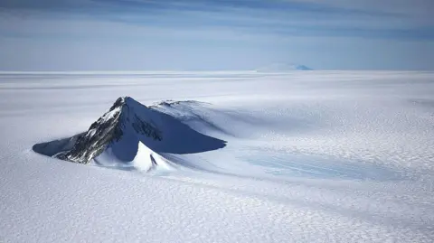
A new map has unmasked the landscape beneath Antarctica's ice in unprecedented detail, something scientists say could greatly enhance our understanding of the frozen white continent.
Researchers used satellite data and the physics of how Antarctica's glaciers move to work out what the continent might look like beneath the ice. They found evidence of thousands of previously undiscovered hills and ridges, and say their maps of some of Antarctica's hidden mountain ranges are clearer than ever before.
While the maps are subject to uncertainties, the researchers believe the new details could shed light on how Antarctica will respond to climate change - and what that means for sea-level rise.
Dr. Helen Ockenden, lead author and researcher at the University of Grenoble-Alpes, noted, It's like before you had a grainy pixel film camera, and now you've got a properly zoomed-in digital image of what's really going on. Beneath Antarctica's ice lies a challenging layer to explore, with much more being known about the surface of some planets than about Antarctica's hidden topography.
The newly created map combines satellite data with an understanding of ice flows, resulting in a visually rich depiction of what lies beneath, vastly increasing knowledge about landforms and how they may impact glacier movement. This insight is crucial for forecasting the effects of climate change on global sea levels.
Notably, the research identified a deep channel within the Maud Subglacial Basin, which is roughly 50m deep and spans a distance comparable to the distance between London and Newcastle. While much remains to learn about this pristine region, ongoing research promises to improve models predicting how Antarctica's ice dynamics will change in a warming climate.
The study offers hope for better predictions regarding how rapid climate change might impact our world.