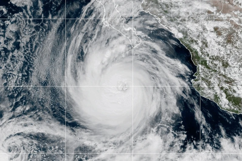
MIAMI (RTW News) — Hurricane Priscilla has weakened significantly as it moves along the west coast of Mexico. By Wednesday morning, the storm was downgraded to a Category 1 hurricane, featuring maximum sustained winds of approximately 80 mph (129 kph), as reported by the U.S. National Hurricane Center.
Despite its weakening status, Priscilla is expected to unleash heavy rains and pose risks of flash floods in areas along Mexico’s Pacific coast and into the southwestern United States.
As of Wednesday, Priscilla was moving northwest at a speed of 8 mph (13 kph), with its center located about 195 miles (314 km) southwest of the southern tip of Baja California.
In the Atlantic, Tropical Storm Jerry is currently churning with top winds of 50 mph (80 kph) and is on track toward the Leeward Islands, moving west-northwest at 23 mph (37 kph). Forecasters predict that Jerry's strength will increase, potentially becoming a hurricane by Thursday.
On Thursday into early Friday, the Leeward Islands could see rainfall amounts between 2 to 4 inches (5 to 10 centimeters), further increasing the risk of flash floods. A tropical storm watch is currently in effect for Antigua, Barbuda, and other nearby islands.
Meanwhile, Baja California Sur is under a tropical storm watch due to Priscilla, particularly from Cabo San Lucas to Cabo San Lazaro. The National Hurricane Center has noted that large waves generated by the storm are impacting the coast of southwestern and west-central Mexico. Notably, a second tropical system, Tropical Storm Octave, is weakening in the Pacific but poses no threat to land.